Transit Maps
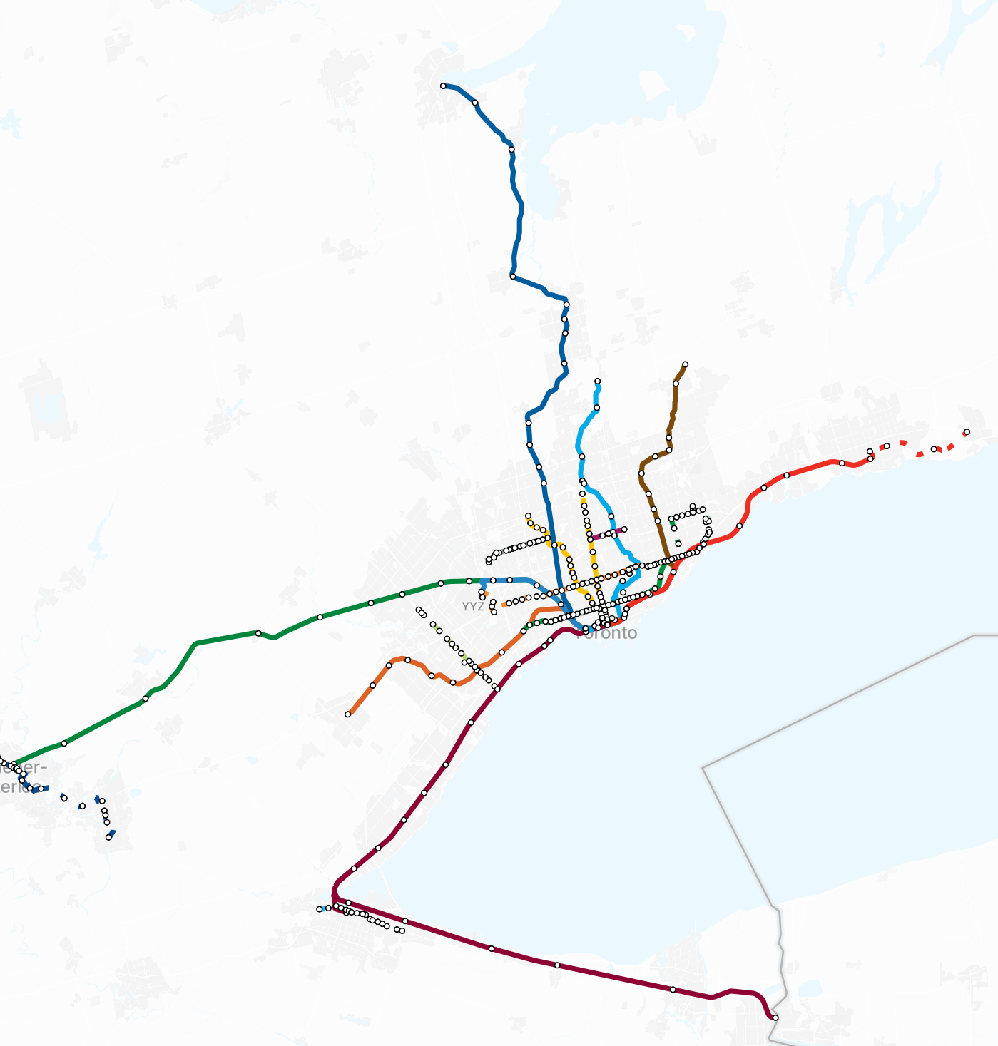
A map of all existing, under construction and planned higher-order transit lines in Canada with key data points.
Measuring Main Streets research tools are designed for practitioners to support better decision making through a more thorough understanding of any main street. We regularly update this selection with new tools, so check back often to discover new ways of measuring your main street!
A map of all existing, under construction and planned higher-order transit lines in Canada with key data points.
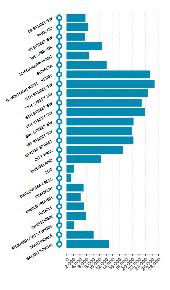
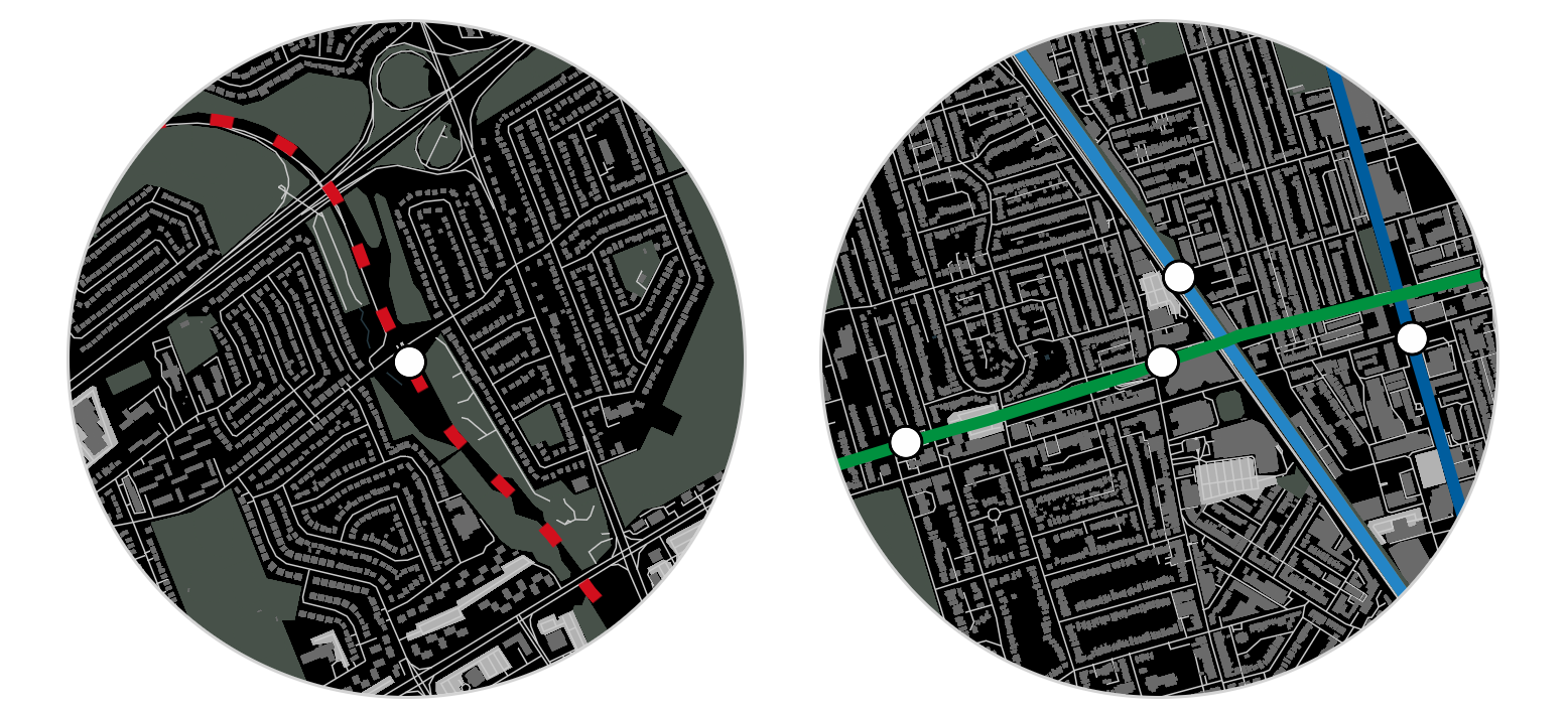
Key data for each stop along a selected transit line.
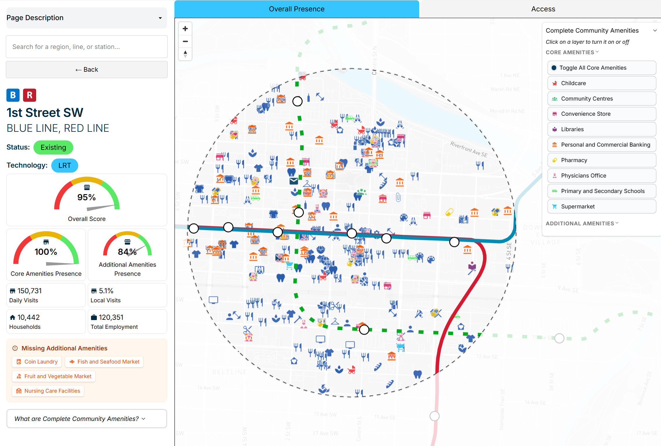
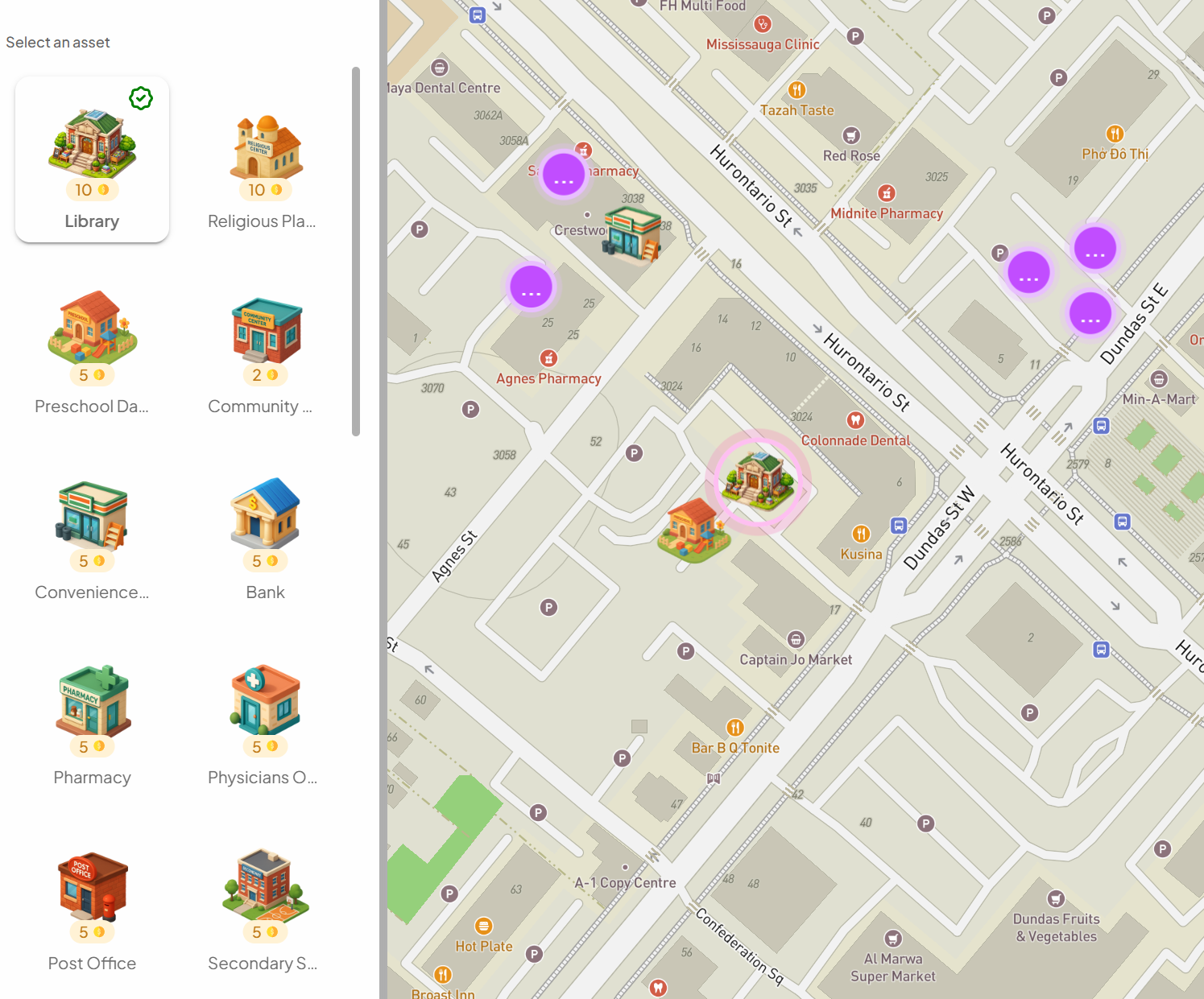
This tool examines the presence and access of key community amenities to assess current completeness and future needs.
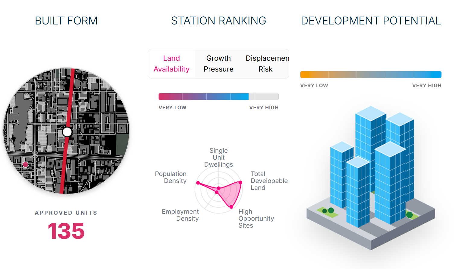
This tool breaks down the housing development potential of areas within 800m of a transit station
This tool highlights the urban form of areas within 800m of a transit station.
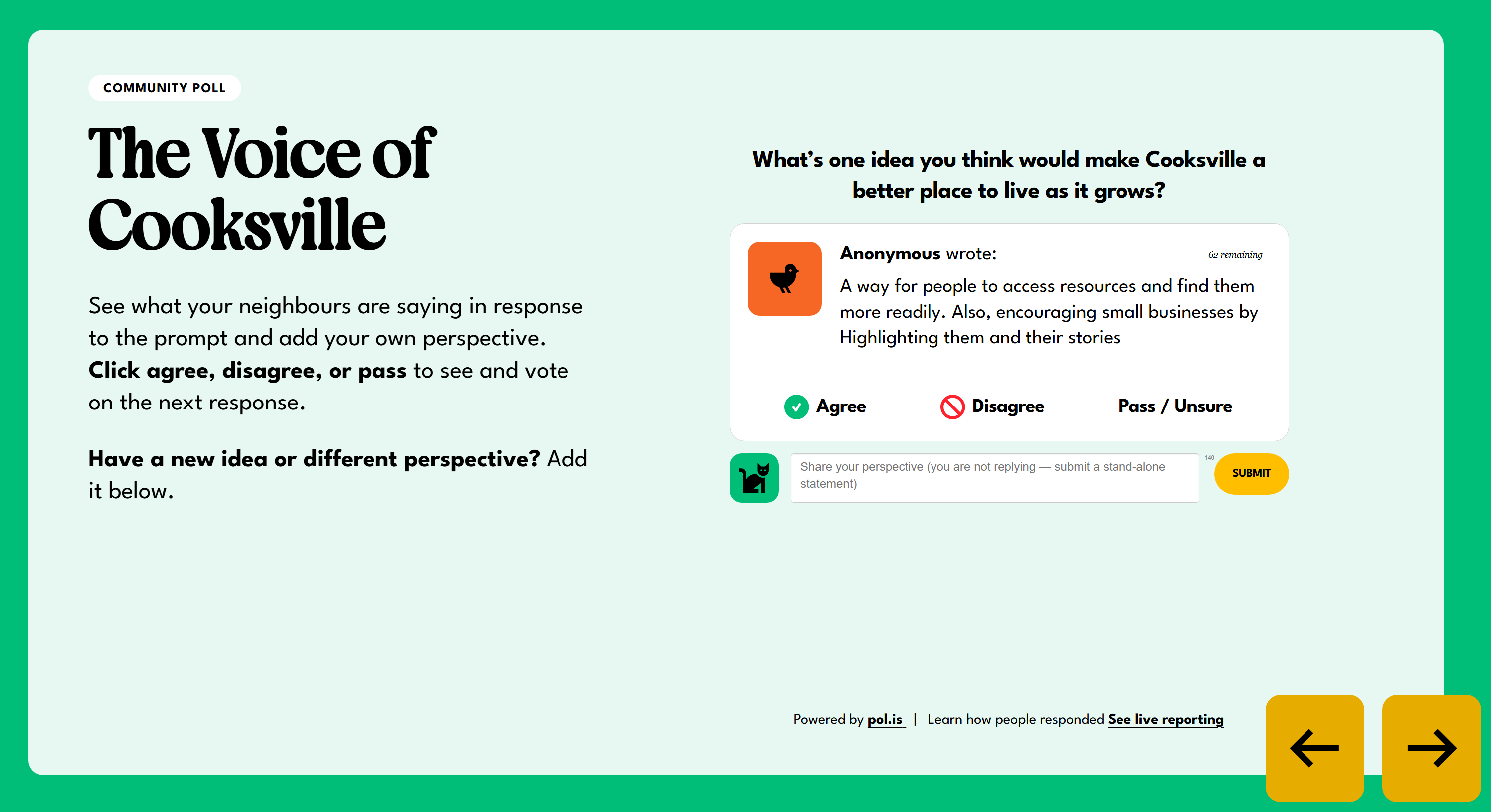
An interactive online experience where people can learn about how the future of their neighbourhood is being shaped.
A community-design interface to help residents design their own open spaces.
An interactive online experience where people can learn about how the future of their neighbourhood is being shaped.

An interactive online experience where people can learn about how the future of their neighbourhood is being shaped.

Demographic variables mapped to all arterial streets.

Relative provision of civic infrastructure by neighbourhood.

This choropleth dot mapping tool highlights housing built in Canada over the course of the past 60 years.
'%3e%3cpath%20d='M40.9476564,60.0464023%20L48.231086,60.0464023%20L48.231086,52.7374246%20L40.9476564,52.7374246%20L40.9476564,60.0464023%20Z%20M40.9476564,39.2601804%20L48.231086,39.2601804%20L48.231086,31.9512026%20L40.9476564,31.9512026%20L40.9476564,39.2601804%20Z%20M50.9936246,49.6532914%20L58.2770542,49.6532914%20L58.2770542,42.3443136%20L50.9936246,42.3443136%20L50.9936246,49.6532914%20Z%20M37,75%20L62,75%20L62,19%20L37,19%20L37,75%20Z'%20id='Fill-280'%20fill='%23002940'%3e%3c/path%3e%3cpolygon%20id='Fill-281'%20fill='%23002940'%20points='68%2032%2068%2075%2077.0226284%2075%2077.0226284%2062.832021%2084.306058%2062.832021%2084.306058%2075%2093%2075%2093%2032'%3e%3c/polygon%3e%3cpath%20d='M10.9527868,60.271111%20L18.2362164,60.271111%20L18.2362164,53.0719657%20L10.9527868,53.0719657%20L10.9527868,60.271111%20Z%20M20.998755,60.271111%20L28.2821846,60.271111%20L28.2821846,53.0719657%20L20.998755,53.0719657%20L20.998755,60.271111%20Z%20M7,75%20L32,75%20L32,43%20L7,43%20L7,75%20Z'%20id='Fill-282'%20fill='%23002940'%3e%3c/path%3e%3cpolygon%20id='Stroke-283'%20fill='%2300ADF2'%20fill-rule='nonzero'%20points='42.9741584%200%2044.4088772%202.56305043%2072.6515431%2053.0170426%2096.0010003%2021.5780499%2099%2023.8333473%2073.9302997%2057.588636%2072.2100566%2059.9048704%2070.7997649%2057.3854576%2042.5811073%206.97474962%203.03371239%2062%200%2059.7922127%2041.2609861%202.38362704'%3e%3c/polygon%3e%3c/g%3e%3c/g%3e%3c/svg%3e)
This graphing tool highlights the visitor recovery patterns from 2020 to 2022.

A downloadable readiness checklist by Open North.